Vancouver Office
Move in progress
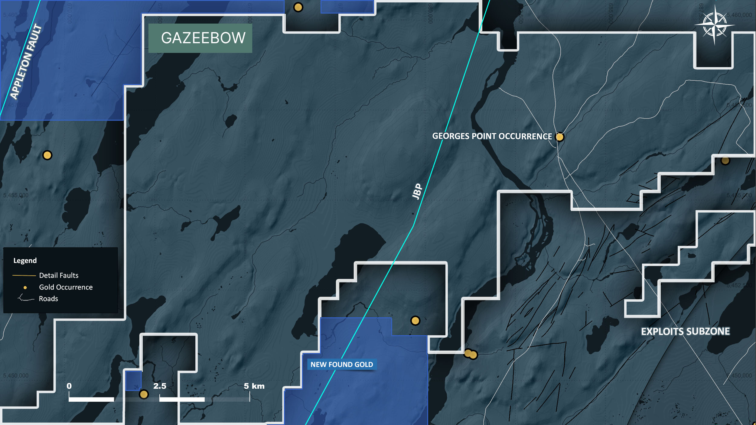
The Gazeebow property consists of 603 mineral claims over an area of 151 km² and is located approximately 30 km north from the town of Gander, Newfoundland. The property is situated approximately 35 km to the northeast of New Found Gold’s Queensway discoveries.
The property is underlain by Early to Late Ordovician marine facies sediments including turbidites and minor conglomerates. Lithologies are characterized by isoclinal folding and penetrative axial planar cleavage.
The property is transected by the highly prospective interpreted Appleton Fault Corridor and Joe Batts Pond Fault, know to host significant high-grade gold mineralization within the Exploits Subzone. The property is also bound by the interpreted Dog Bay Line to the west and GRC Line to the east.
A portion of the Gazeebow property was covered by Exploits’ 2021 extensive VTEM survey.
Exploits’ 2022 exploration activities include extensive prospecting and mapping, as well as a localized till sampling.
An infill airborne VTEM geophysical survey and localized high-resolution LiDAR survey is planned for late-fall of 2022.
We promise not to send you any spam, only the news about our latest discoveries and findings