Vancouver Office
Move in progress
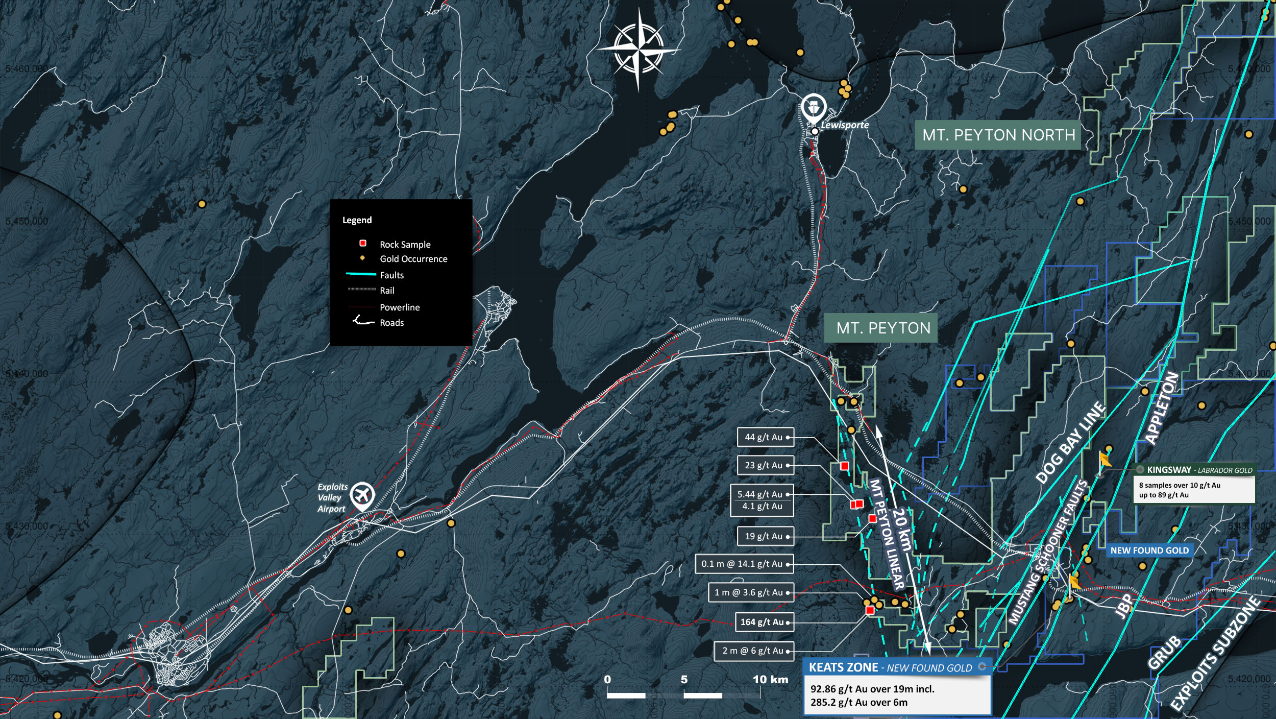
The Mount Peyton property consists of 722 mineral claims and encompass a land area of 181 km². This area is accessible by traveling west on the Trans-Canada Highway 15 km past the town of Glenwood, Newfoundland.
The property is predominantly underlain by the Silurian to Devonian aged Mt. Peyton Intrusive Suite rocks, and lesser Late Ordovician to Silurian siliciclastic sediments. Diorite, monzonite, and gabbro phases of the intrusive suite occur throughout the property. Locally these phases are crosscut by narrow aplite and tonalite dykes.
2021 exploration at the Mt. Peyton property consisted of a property wide VTEM airborne geophysical survey, ground geophysics, and localized soil sample grids.
2021 drilling at the Schooner (North and South) target areas consisted of 18 drill holes targeting the interpreted northeast-southwest trending Schooner Fault zone.
We promise not to send you any spam, only the news about our latest discoveries and findings