Vancouver Office
Move in progress
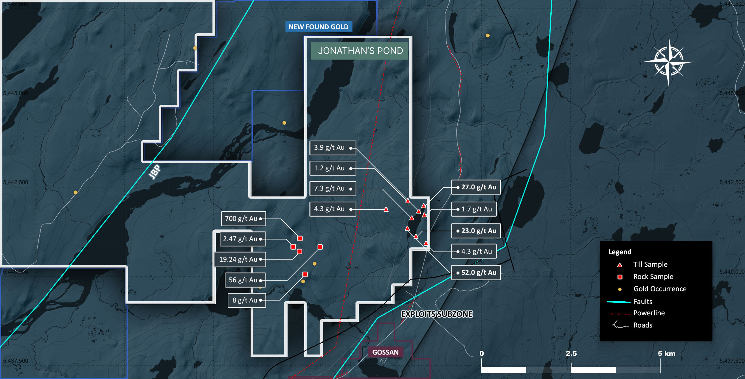
The Jonathan’s Pond property consists of 198 mineral claims and encompasses a land area totaling 50 km²
The Jonathan’s Pond project is situated around the GRC Line, a regional scale trans- compressional thrust fault marked by a discontinuous belt of ophiolitic rocks that forms the easternmost boundary of the Exploits Subzone. In the western portion of the property the GRC Line is unconformably overlain by Early to Late Ordovician siliciclastic sediments. Gold deposition in the Exploits Subzone is found in secondary and tertiary structures crosscutting siliciclastic sediments bounded by the GRC line.
2021 exploration at Jonathan’s Pond consisted of a VTEM airborne geophysical survey, ground magnetic geophysical survey, and localized soil sampling grid.
2021 drilling at the Jonathan’s Pond ‘Main Vein’ target consisted of 21 drill holes. Drill hole JP-21-019 intersected a 1.57 g/t Au over 4.5 m from 16 to 20.5 m. This intercept is interpreted as being coincident with anomalous gold samples collected from a 2020 surface trenching program. Based on the 2020 trenching and these results, this potential mineralized trend remains open to the west and is largely untested.
We promise not to send you any spam, only the news about our latest discoveries and findings