Vancouver Office
Move in progress
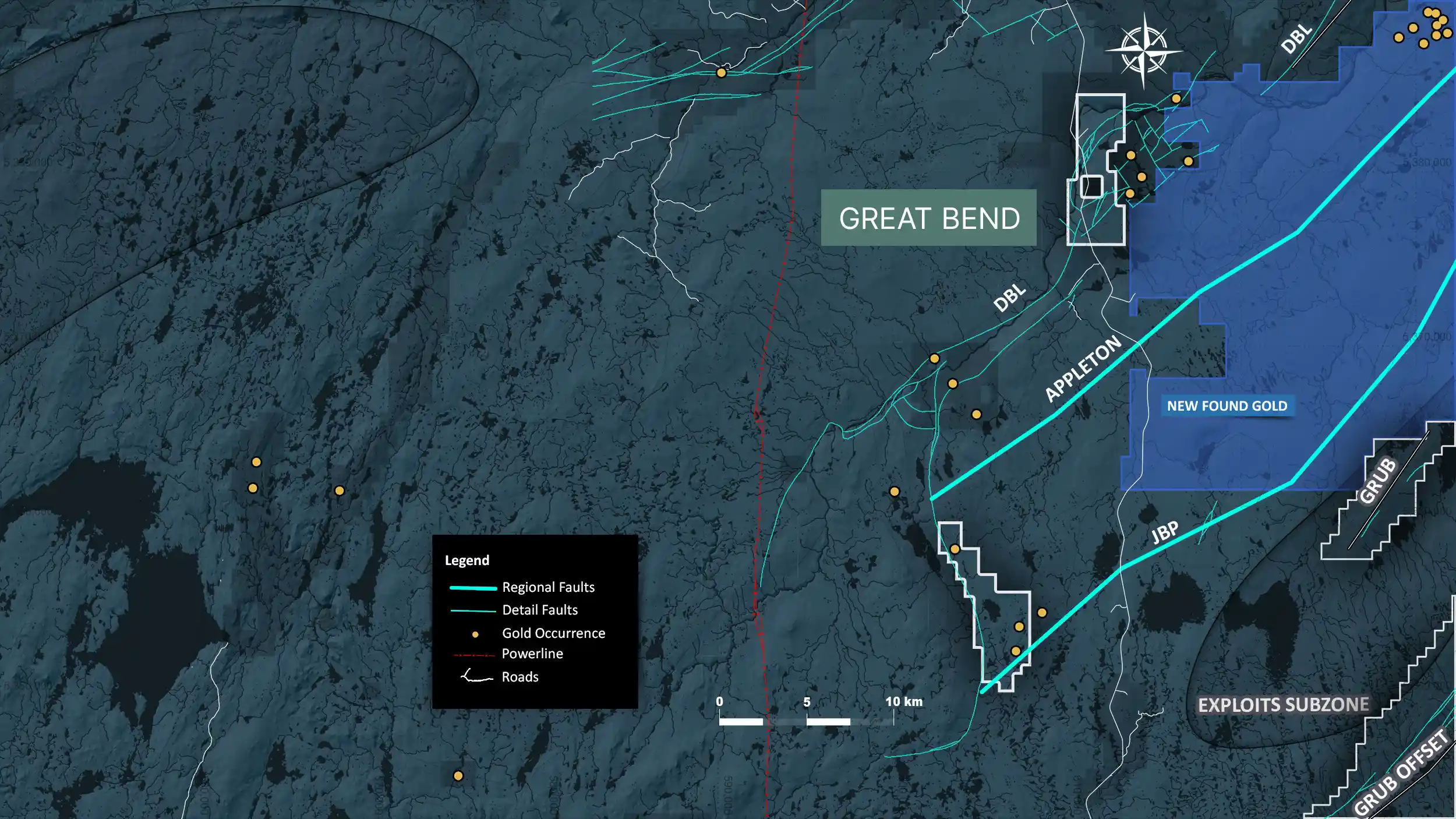
The Great Bend Property consists of 1,800 mineral claims encompassing a land area of 450 km². The heart of the property can be accessed by traveling 76 km south from the town of Bishops Falls on the Bay d’Espoir Highway.
The Great Bend property is underlain by Cambrian to Ordovician ophiolitic ultramafic rocks, Ordovician felsic to intermediate island-arc volcanics and siliciclastic sediments, as well as Ordovician marine siliciclastic sediments. The southwest property margin contains the northeast edge of the Early Ordovician Partridgeberry Hills granite which truncates the ophiolite and siliciclastic packages.
Structurally, the property is transected by the interpreted southwest extension of the Appleton Fault Corridor, Dog Bay Line, and Joe Batts Pond Fault. These structures are known to host significant high-grade gold mineralization within the Exploits Subzone.
We promise not to send you any spam, only the news about our latest discoveries and findings